

Table Rock Trail Hike in Dixville Notch State Park
Discover the natural beauty of New Hampshire's White Mountains with a rewarding hike to Table Rock, offering unparalleled views and a memorable adventure.
Last updated: Apr 2024
Free access
Description
Perfect for
 For solo
 For two
 Outdoorsy
TikTok videos
Itinerary
- Start at the Trailhead: Choose between Trail 50 for a moderate hike or Trail 57 for a steep climb. Trailheads are located along Highway 26.
- Hike to the Summit: Follow the chosen trail up to Table Rock, enjoying the changing landscapes and preparing for the hike's challenges.
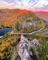
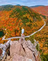
- Enjoy the Summit Views: Take in the breathtaking scenery from Table Rock, but exercise caution due to the steep drop-offs.
- Return Journey: Descend using Trail 50, regardless of your ascent path, for a safer and more moderate hike back.
 Packing List
- Sturdy hiking boots for traction
- Water bottle to stay hydrated
- Sunscreen and bug spray for protection
- Headlamp for early morning or late hikes
- Camera to capture the scenic views
- Snacks for a picnic at the summit
- Mask and hand sanitizer for safety
4.7 ● Google reviews
Tran Le
3 years ago
Short uphills climb with some flat surface walks. Around less than 1 miles you will reward with a spectacular view.Lisa
9 years ago
TABLE ROCK (2,540 ft.): This stark protruding cliff is formed of vertical slabs. It is less than 10 feet wide at its narrowest point. The vertical drop from table rock is 700 feet. Use Caution! The view is spectacular! Directions to Table Rock are: Take Route 26 east from Colebrook about 10 miles. Park in the gravel area on the right, about 150 feet prior to reaching the top of Dixville Notch, the trail ascends almost vertically from the parking area. The trail starts almost directly behind the big sign "Entering Dixville Notch State Park." This trail is steep and rocky and should NOT be attempted when wet. The trail is 0.3 miles from the parking area to Table Rock.. The alternate route is accessible from a trail originating on Route 26, 0.2 miles east of the junction of the access road to The Balsams/Wilderness Ski Area and Route 26. Park off the road shoulder in the grassy clearing on the right. The trail starts 70 feet before the yellow caution diamond road sign with the profile of a person. This trail is well marked, with many small signs. The alternate route is the safest way to climb up!Riya Dahal
2 years ago
Absolutely beautiful! Hike can be steep but would say it's moderate only due to the elevation gain. The rock was a little scary but worth it for me. There are definitely wider sections. Absolutely beautiful!William I. Dawe II
5 years ago
Awesome view, pay attention to windy days though.Dan Dex
4 years ago
It is a very difficult and dangerous hike for beginners. The rocks are slippery with so much algae on them. All the trees along the way are either fallen or too easy to get fallen if you try to take support by holding them. I am rookie and tried to hike this place without any gear. It took some 30 minutes to me just to climb half way safe and then decided to climb down without going to the top point. It took another 30 to climb down safe. Even though they say its only 1.5 mile I felt it is more than 2 miles at least.


